A Myanmar map is your key to unlocking the wonders of this Southeast Asian gem. Known as the Myanmar Burma map due to its former name, it reveals a land of ancient temples, vibrant cultures, and stunning landscapes. A Myanmar tour package paired with a detailed map of Myanmar helps travelers explore from bustling cities to remote islands. Whether you're drawn to Yangon’s golden pagodas or the untouched Mergui Archipelago, a Myanmar country map ensures an unforgettable journey through this diverse nation.
Myanmar Map and Geographical Overview
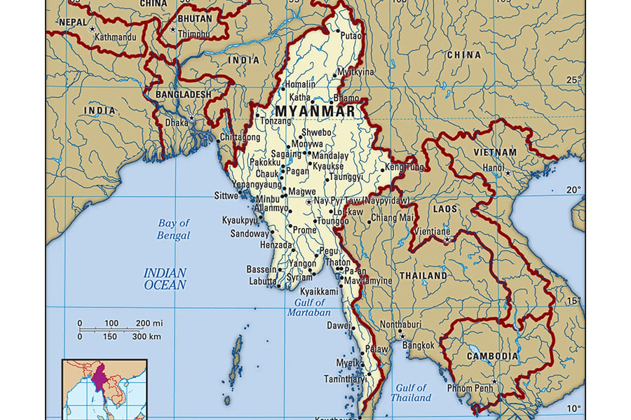
The Myanmar map showcases a country spanning 676,580 square kilometers, making it Southeast Asia’s second-largest nation. Shaped like a kite with a long tail along the Malay Peninsula, Myanmar borders Bangladesh, India, China, Laos, Thailand, and the Bay of Bengal. Its 2,227-kilometer coastline and 6,523-kilometer land borders highlight its strategic position.
The Irrawaddy River valley, a fertile heartland, supports much of Myanmar’s population and economy. Surrounding mountains and plateaus create dramatic landscapes, rich in jade, petroleum, and teak.
Myanmar lies between latitudes 10°N and 28°N and longitudes 92°E and 101°E on the Indochinese Peninsula. The map of Myanmar shows a population of about 55 million, with dense settlements in central plains and sparse populations in rugged borders. It’s divided into seven states, seven regions, and one union territory, reflecting ethnic diversity.
Cities like Yangon (over 5 million residents) and Mandalay thrive, while Naypyidaw is the capital. The climate ranges from tropical monsoons in lowlands to alpine conditions in higher elevations.
Southern Myanmar Map
Southern Myanmar, on the Myanmar map, features the Tenasserim Plains and Southeastern Hills. A narrow coastal strip, backed by the Tenasserim Range, extends southward, bordering Thailand.
The Myanmar Burma map highlights the Mergui Archipelago, with over 800 islands in the Andaman Sea. Short rivers like the Dawei and Tanintharyi support mangroves and coral reefs, key biodiversity hotspots. Bilauktaung is the highest peak in this range, linked to Malaysia’s mountains.
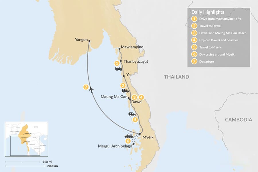
Cultural landmarks like Mount Zwegabin and Kyaiktiyo Pagoda (Golden Rock) draw pilgrims and hikers. Heavy monsoon rains create lush rainforests and rubber plantations. The map of Myanmar shows Tanintharyi Region, famous for Ngapali Beach and eco-tourism islands. Isolation preserves traditional fishing communities and endangered wildlife in mangroves, making it a must-visit for nature lovers.
Northern Myanmar Map
The northern Myanmar map is dominated by the Northern Mountains, an extension of the Himalayas. Hkakabo Razi, at 5,881 meters in Kachin State, is Southeast Asia’s highest peak. The Myanmar Burma map shows the Irrawaddy River’s source at the N'mai and Mali rivers’ confluence. Parallel ranges border India and China, with deep valleys carved by fast rivers. The climate shifts from subtropical to arctic-like at higher elevations.
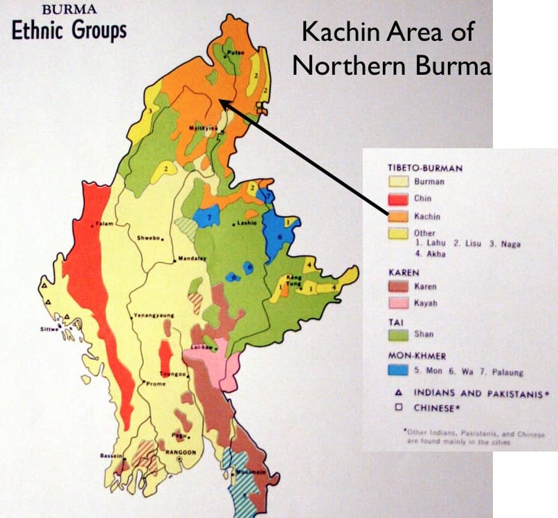
Ethnic Kachin communities thrive here, alongside jade mining. Myitkyina, a rail hub, and Putao, a trekking base, are key cities. The Myanmar country map highlights Hkakabo Razi National Park, home to rare species. This region’s rugged beauty and ecological importance make it ideal for adventure travelers.
Eastern Myanmar Map
Eastern Myanmar’s map features the Shan Plateau, rising to 600 meters. Covering 283,000 square kilometers, it includes the Salween River’s dramatic gorges. The Myanmar Burma map shows the Shan Hills, Karen Hills, and Dawna Range, bordering Laos and Thailand. These form part of the Kayah-Karen rain forests, a conservation priority. Loi Pangnao, at 2,563 meters, stands out.
Shan State, the largest division, is known for ethnic diversity and Taunggyi’s markets. Inle Lake, with its leg-rowing fishermen, is a highlight on the Myanmar country map. The Thanlwin River holds hydropower potential, though controversial. Cooler highlands offer relief from lowland heat, attracting visitors seeking nature and culture.
Western Myanmar Map
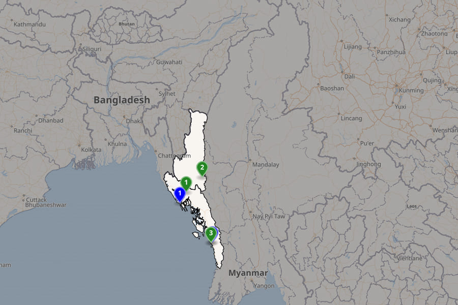
The western Myanmar map features the Arakan Mountains, running along the Bay of Bengal. This range, on the Myanmar Burma map, reaches near Cape Negrais, isolating the coast. Rakhine State, with Sittwe as a port city, dominates. The map of Myanmar shows mangrove deltas and Ngapali Beach, a tourist favorite. The Kaladan River supports rice and fisheries.
Bordering Bangladesh and India, the Naf River marks the boundary. Chin State’s rugged Chin Hills, home to tattooed tribes, include Mount Victoria at 3,053 meters. Intense monsoons bring lush vegetation but also landslides. Mrauk U’s ancient temples add historical depth to this coastal region.
Using Myanmar Maps for Travel and Tourism
A Myanmar map is essential for exploring this captivating destination. A Myanmar tour package often includes interactive Myanmar Burma maps to plan trips from Yangon to remote areas. The map of Myanmar highlights safe hubs like Yangon’s Shwedagon Pagoda and Mandalay’s U Bein Bridge. Trace Irrawaddy River cruises from Bagan’s 2,000 temples to northern frontiers.
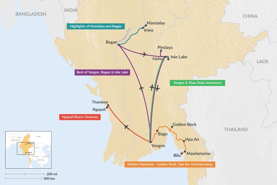
In the south, maps guide to Ngwe Saung beaches and the Mergui Archipelago for snorkeling. Eastern routes lead to Inle Lake and Pindaya Caves, while northern treks reach Putao. Western explorations include Mrauk U and Ngapali Beach. Offline map apps offer updates, but check advisories, as some border areas are restricted. Myanmar tour packages with detailed maps ensure safe, enriching adventures.